SkyTEM helicopter
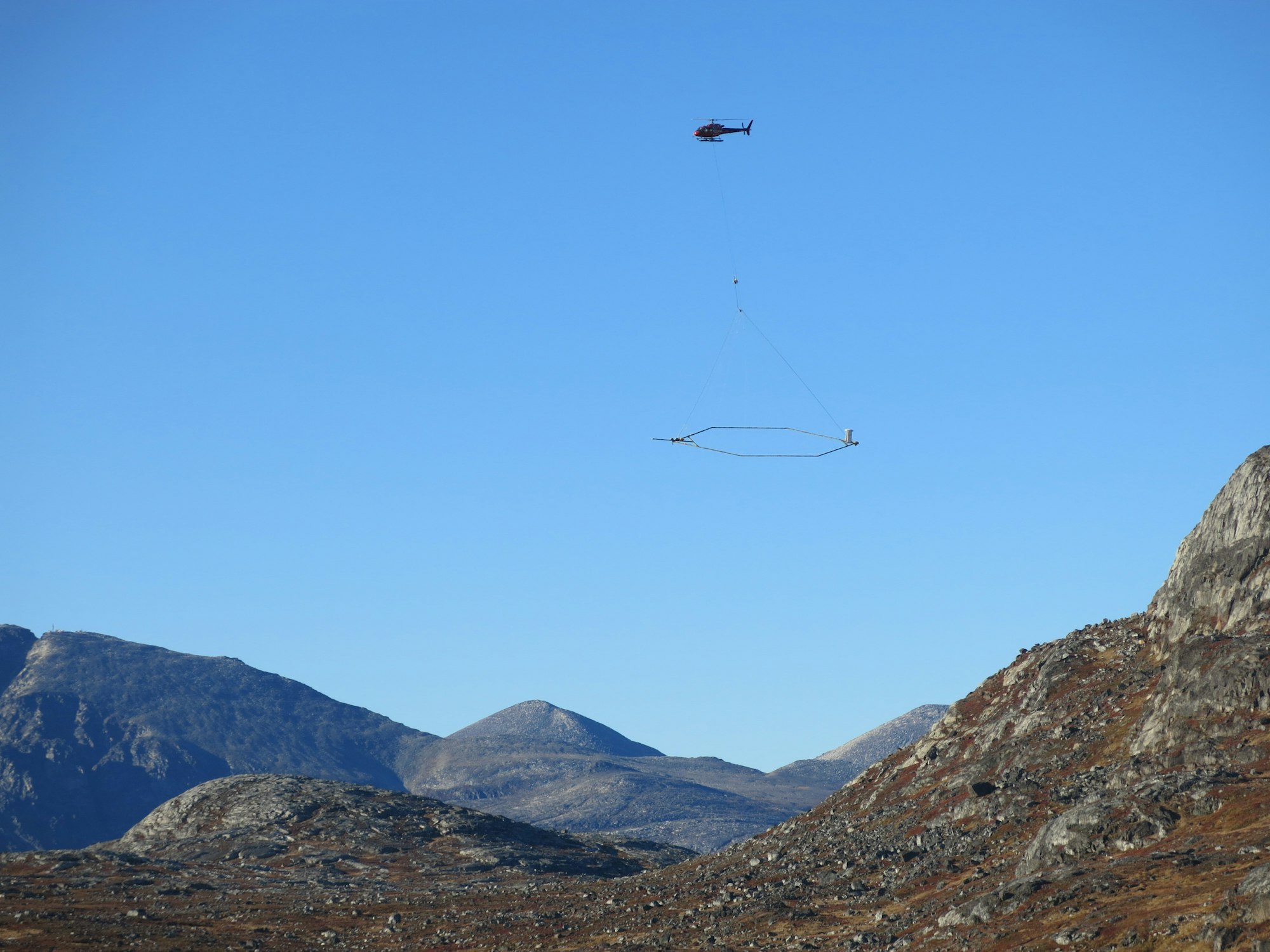
What is that helicopter doing?
See video and explaination of SkyTEM technology mapping underground aquifers.
Helicopter liftoff with SkyTEM technology
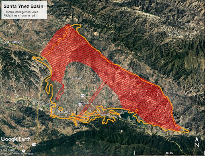
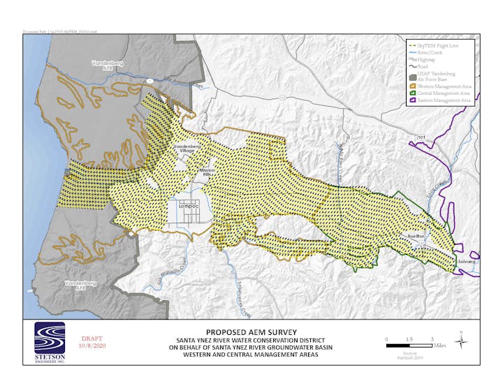
Press Release - AEM Survey of Basin (Nov. 2020)
PR_helicopter_survey_allMA_2020-11.pdfFlight maps -EMA-CMA-WMA_2020-11.pdf